You must turn on the browser location services to get the route from your current location to the sign, and the distance (as the crow flies) from your current location to the sign.
After activating location services, refresh the page.
On the sign:
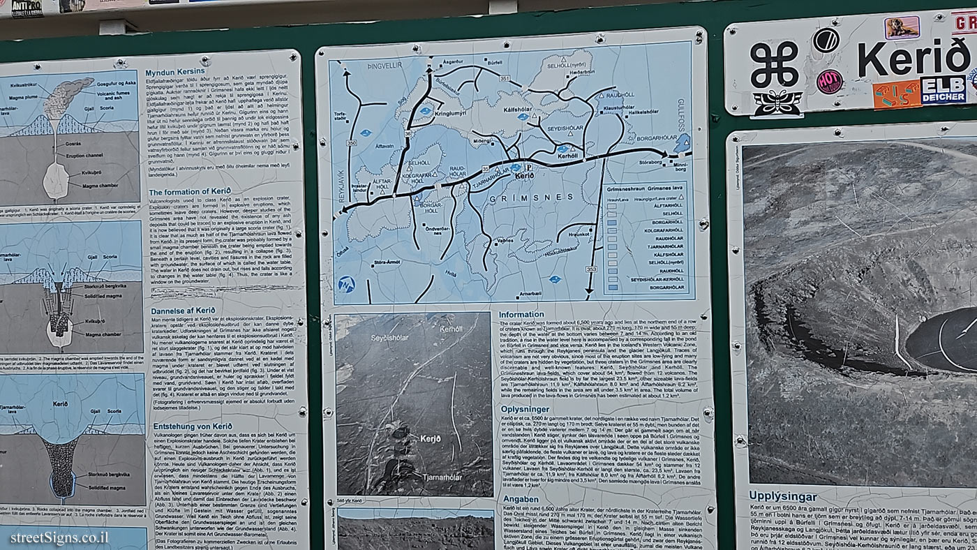
Kerið [Sweden National heritage sign]
[The text appears in Icelandic, English, Danish and French. (Below is the text in English only (it was difficult to decipher the other languages]
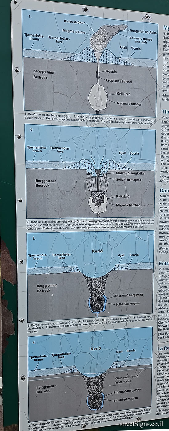
The formation of Kerið Vulcanologists used to class Kerio as an explosion crater. Explosion craters are formed in explosive eruptions, which sometimes leave deep craters. However, deeper studies of the Grímsnes area have not revealed the existence of any ash deposits that could be traced to an explosive eruption in Kerið, and it is now believed that it was originally a large scoria crater (fig. 1). It is clear that as much as half of the Tjarnarhólahraun lava flowed from Kerið. In its present form, the crater was probably formed by a small magma chamber beneath the crater being emptied towards the end of the eruption (fig. 2), resulting in a collapse (fig. 3) Beneath a certain level, cavities and fissures in the rock are filled with groundwater, the surface of which is called the water table. The water in Kerið does not drain out, but rises and falls according to changes in the water table (fig. 4). Thus, the crater is like a window on the groundwater.
[Map]
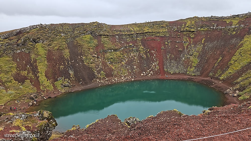
Information The crater Kerið was formed about 6,500 years ago and lies at the northem end of a row of craters known as Tjarnarhólar. It is oval, about 270 m long, 170 m wide and 55 m deep; the depth of the water at the bottom varies between 7 and 14 m. According to an old tradition, a rise in the water level here is accompanied by a corresponding fall in the pond on Bürfell in Grímsnes and vice versa. Kerið lies in the Iceland’s Western Volcanic Zone, which runs through the Reykjanes peninsula and the glacier Langjökull. Traces of volcanism are not very obvious, since most of the eruption sites are low-lying and many of the craters are hidden by vegetation, but three craters in the Grímsnes area are clearly discernable and well-known features: Kerið, Seyðishólar and Kerhóll. The Grímsneshraun Lava-fields, which cover about 54 km², flowed from 12 volcanos. The Seyðishólar-Kerhólshraun field is by far the largest 23.5 km² other sizeable lava-fields are Tjarnarhólahraun 11.9 km², Kálfshólahraun 8.0 km² and Álftarhólshraun 6.2 km². while the remaining fields in the area are all under 3.5 km² in area. The total volume of lava produced in the lava-flows in Grímsnes has been estimated at about 1.2 km³.


 Click for a larger image