You must turn on the browser location services to get the route from your current location to the sign, and the distance (as the crow flies) from your current location to the sign.
After activating location services, refresh the page.
On the sign:
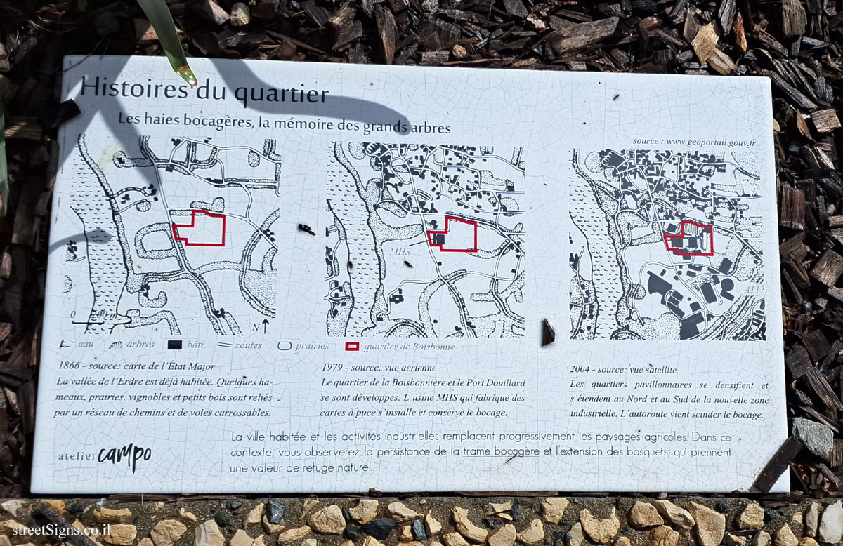
Histoires du quartier Les haies bocagères, la mémoire des grands arbres
[map 1] 1866-source: carte de l ’État Major La vallée de l’Erdre est déjà habitée. Quelques hameaux, prairies, vignobles et petits bois sont reliés par un réseau de chemins et de voies carrossables.
[map 2] 1979-source: vue aérienne Le quartier de la Boisbonnière et le Port Douillard se sont développés. L’usine MHS qui fabrique des cartes à puce’s ’installe et conserve le bocage.
[map 3] 2004 - source: vue satellite Les quartiers pavillonnaires se densifient et s’étendent au Nord et au Sud de la nouvelle zone industrielle. L’autoroute vient scinder le bocage.
La ville habitée et les activités industrielles remplacent progressivement les paysages agricoles Dans ce contexte, vous observerez la persistance de la trame bocggère et l’extension des bosquets, qui prennent une valeur de refuge naturel.
[map 1] 1866-source: map of the General Staff The Erdre valley is already inhabited. A few hamlets, meadows, vineyards and small woods are connected by a network of paths and carriageways.
[map 2] 1979-source: aerial view The Boisbonnière district and Port Douillard have developed. The MHS factory which manufactures smart cards installs and maintains the bocage.
[map 3] 2004 - source: satellite view The residential neighborhoods are becoming denser and extending to the North and South of the new industrial zone. The highway splits the bocage.
The inhabited city and industrial activities are gradually replacing the agricultural landscapes. In this context, you will observe the persistence of the boggère network and the extension of the groves, which take on the value of a natural refuge.