The sign is rectangular but its head is designed according to the silhouette of the old building of the Gymnasia Herzliya, which serves as a logo of the Council for the Preservation of Heritage Sites in Israel
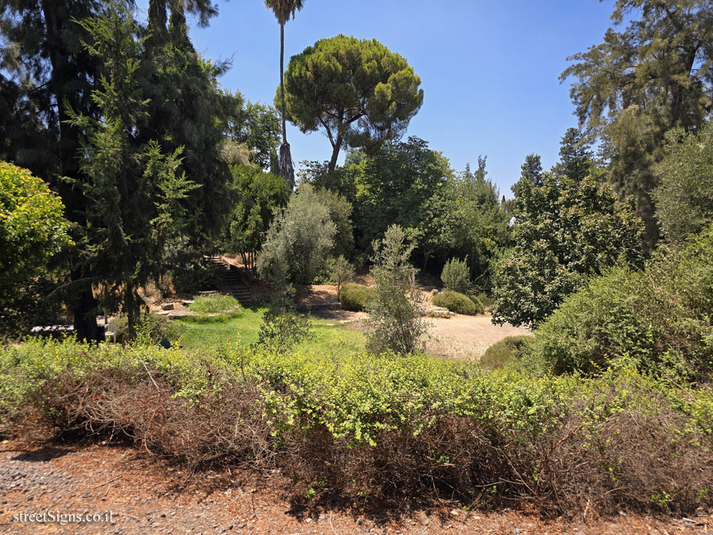
The mound was photographed on the same day by the same photographer
 Click for a larger image
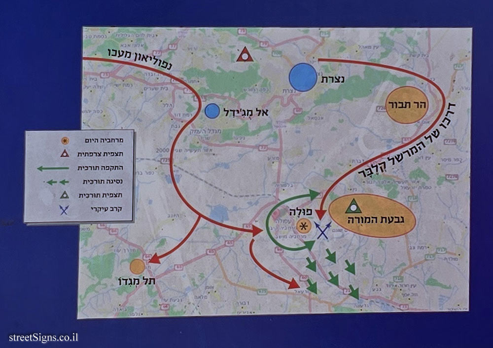
 The "Battle of Mount Tabor" map on the sign appears here at magnification
 Click for a larger image
 The Crusader fortress "La Feve" is commemorated on a separate plaque
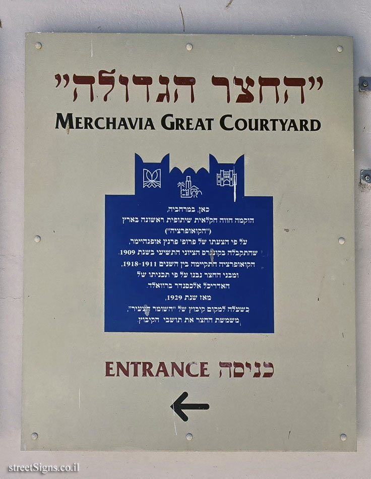
 Click for sign's details Translation of the text on the sign
:
Symbol of the Council for the Preservation of Israeli Heritage Sites
Symbol of the Jezreel Valley Regional Council
The symbol of the Ministry of Culture and Sports
Kibbutz Merhavia symbol
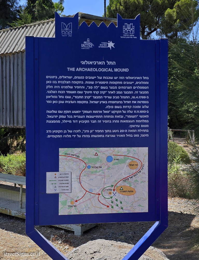
THE ARCHAEOLOGICAL MOUND In this archaeological mound there are layers of Canaanite, Israeli, Byzantine and Mamluk settlements, settlements from different periods of history. During the Crusader period, the French Templars built a fort here called "La Feve", and the moat in front of us was part of this fort. The fort was abandoned after the "Battle of Hattin" in which the Crusader force was destroyed. On April 16, 1799, the "Battle of Mount Tabor" was fought around the remains of the fortress, in which Napoleon Bonaparte won the greatest of his victories in the Land of Israel. In the Arab period there was a wretched and fever-stricken village called Pula.
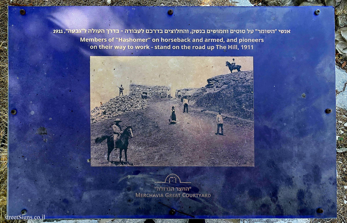
On 11.11.1910, the "redeemer of the valley’s lands" Yehoshua Hankin stepped onto the land with three of the "Hashomer" men, thus opening the Hebrew settlement in the entire Jezreel valley. During the War of Independence, kibbutz member David Meisler was killed in this moat by a bomb from an Iraqi plane.
At the beginning of the 20th century, a "Gan Nadav" was planted inside the moat, in memory of kibbutz member Nadav Mintzer, an air force navigator who was murdered while on vacation in India by his local companions.
[Map depicting the progress of the forces in the "Battle of Mount Tabor"]


 Click for all signs belonging to Heritage Sites in Israel
 Click for the map of all signs belonging to Heritage Sites in Israel
  Click for the route that starts with this sign and goes through the signs belonging to Heritage Sites in Israel
 Click for more details on Heritage Sites in Israel
 The closest sign from this series (13 Meter): Merhavia - Heritage Sites in Israel - The Crusader Fortress "La Feve"
 55 Meter
 58 Meter
 60 Meter
 63 Meter
 68 Meter