You must turn on the browser location services to get the route from your current location to the sign, and the distance (as the crow flies) from your current location to the sign.
After activating location services, refresh the page.
On the sign:
[An illustration of a ship, symbolizing the symbol of Paris]
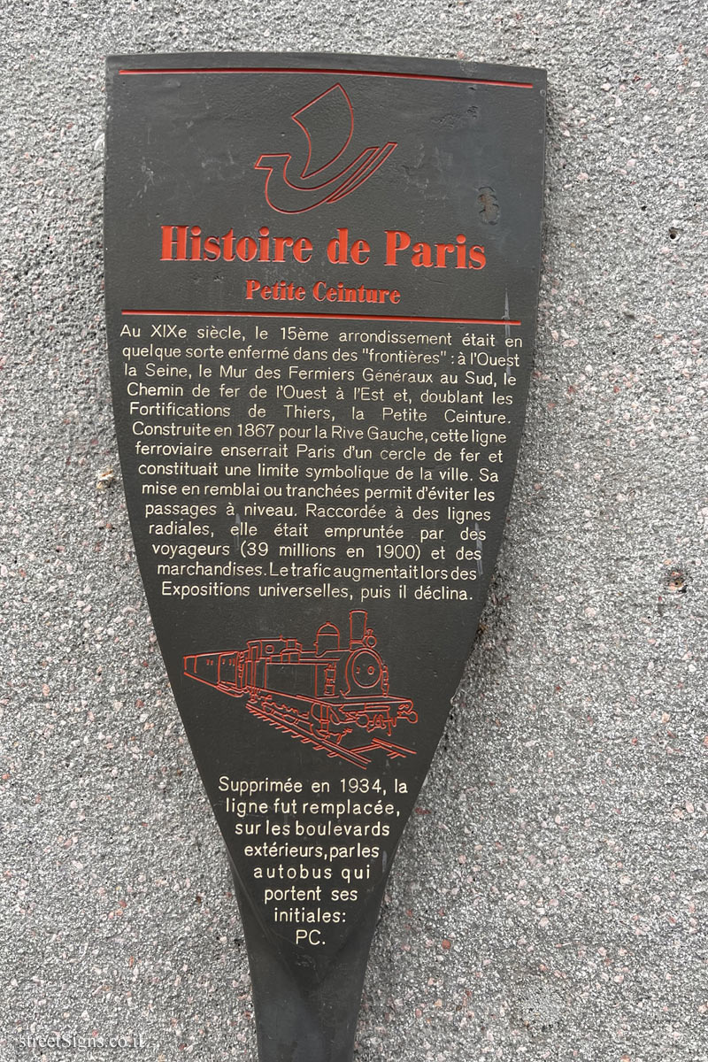
Histoire de Paris
Petite Ceinture Au XIXe siècle, le 15ème arrondissement était en quelque sorte enfermé dans des "frontières": à l’Ouest la Seine, le Mur des Fermiers Généraux au Sud, le Chemin de fer de l’Quest à l’Est et, doublant les Fortifications de Thiers, la Petite Ceinture. Construite en 1867 pour la Rive Gauche, cette ligne ferroviaire enserrait Paris d’un cercle de fer et constituait une limite symbolique de la ville. Sa mise en remblai ou tranchées permit d’éviter les passages à, niveau. Raccordée à des lignes radiales, elle était empruntée par des voyageurs (39 millions en 1900) et des marchandises. Le trafic augmentaitlors des Expositions universelles, puis il déclina.
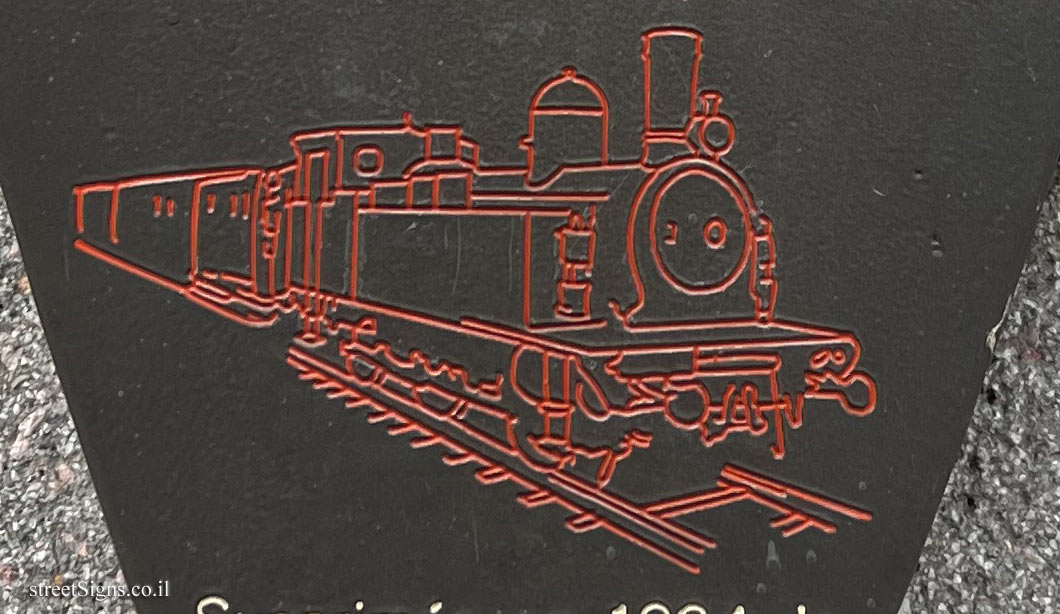
[Illustration of a train that operated on this line]
Supprimée en 1934, la ligne fut remplacée, sur les boulevards extérieurs,parles autobus qui portent ses initiales: PC.
One of the series of signs describing historical places in Paris. The signs were placed starting in 1992 and are also called sucettes Starck (Starck’s Lollipops) after Philippe Starck who designed them.
The sign depicts the ring railway line that marked the border of Paris. The line was canceled in 1934.
The illustration of the train in the center of the cover is shown here at magnification Click for a larger image
Translation of the text on the sign:
[An illustration of a ship, symbolizing the symbol of Paris]
History of Paris
The "Small Belt" In the 19th century, the 15th arrondissement was in some way enclosed within "borders": the Seine to the West, the Wall of the Farmers General to the South, the Chemin de fer de l’Quest to the East and, doubling the Fortifications from Thiers, the Petite Ceinture. Built in 1867 for the Left Bank, this railway line surrounded Paris with an iron circle and constituted a symbolic limit of the city. Its embankment or trenches made it possible to avoid level crossings. Connected to radial lines, it was used by travelers (39 million in 1900) and goods. Traffic increased during the Universal Exhibitions, then declined.
[Illustration of a train that operated on this line]
Abolished in 1934, the line was replaced, on the outer boulevards, by buses which bear its initials: PC.


 Click for a larger image
 ") Click for all signs belonging to The History of Paris (Starck's Lollipops)
Click for all signs belonging to The History of Paris (Starck's Lollipops)
 3.97 Km |
  4.04 Km |
  4.06 Km |
  4.09 Km |
  4.18 Km


") Click for the map of all signs belonging to The History of Paris (Starck's Lollipops)
Click for the map of all signs belonging to The History of Paris (Starck's Lollipops) ") Click for the route that starts with this sign and goes through the signs belonging to The History of Paris (Starck's Lollipops)
Click for the route that starts with this sign and goes through the signs belonging to The History of Paris (Starck's Lollipops)") The closest sign from this series (3.83 Km): Paris - History of Paris - Gustave Doré
The closest sign from this series (3.83 Km): Paris - History of Paris - Gustave Doré